Simply put, a Geographic Information System (GIS) is a computerized system of capturing and storing spatial data, which can then be manipulated, analyzed and displayed into an accurate picture of a specific area. Many state and local governments, as well as the federal government, are building massive GIS databases that are available to surveyors and professionals in other fields.
Through the sharing and updating of GIS data, it is possible to maintain precise picture of a region so to better manage its growth. For example, government entities and contractors can see instantly where too much development is wearing streets or sewer systems. If this data is properly inventoried in a single database, all contractors access the same, accurate data, significantly saving time and money, as well as future problems.
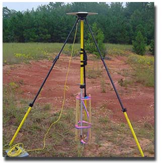
Seiler & Associates utilizes the latest in Trimble GPS (global positioning system) ) and software and can provide data in a compatible format for insertion into any existing GIS system.