The ancient Egyptians first used Boundary, or Land, Surveys* to accurately divide land for tax purposes. But it was the Eighteenth Century birth of the Industrial Revolution that brought surveying to its prominent position in business and government. The demand for railroads, canals, and roadways made the determination of exact boundaries a necessity.
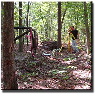
Today, land is more precious than ever. In response, surveying has become more accurate and exact. In its simplest state, a boundary survey reestablishes boundaries based on historical evidence and documents of record. The surveyor may also plan and establish property boundaries, or certify previous work - often required by local ordinances for land transfers or development.
A Boundary Survey may be called for in a number of circumstances:
· Before
a land title is conveyed
· Before land is subdivided
· Before undertaking improvements to property
· Before land is partitioned by will
Click here for more information.
An accurate boundary survey is a vital first step for any property acquisition or development. Seiler & Associates’ combination of practical experience and knowledge of the latest technology provides you with a professional survey that exceeds state requirements. You can rest assured that your property is everything you bargained for.
*While often used interchangeably, the first term implies political boundaries, while privately-held lands are the focus of the second.